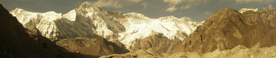
Changes in glacier size are one of many options for generating a proxy record for climate. It basically works like this: A glacier adjusts its size and geometry towards a state that can be stably sustained by the prevailing climate. A contracted glacier means climate conditions that favour ice ablation over snow accumulation (warmer, drier, more clear skies …) while an expanded glacier means climate conditions that favour snow accumulation and preservation over ice ablation (wetter, colder, cloudier …).
Geomorphologists use marks on the landscape such as moraines, trimlines and kame terraces to figure out the larger former extent of glaciers, and then glaciologists undertake surface energy balance studies, mass balance measurements and modelling studies of the modern glaciers to figure out the connection between the climate and the glacier mass gain or loss at a specific glacier. This relationship is then used as the basis for understanding what of the contending climate conditions is the most likely explanation of the former glacier extent. This can be cross-checked against other records; for example if a glacier-climate model suggests a formerly wetter climate, this can be checked against regional lake levels and pollen records that also have independent information on whether or not the lakes in the region were at highstand and if the vegetation was that of a wetter climate.
In our project on the Lewis Glacier of Mt Kenya we explored the possibility of using the changes in the size of the glacier as a proxy for changing climate conditions. To do this, we applied a computer model that uses inputs of meteorological conditions from the weather station we set up on the glacier to plug into calculations of the mass and energy exchanges that occur at the glacier surface and govern the total mass change of the glacier. In order to account for how conditions change over the glacier surface we need to include some information on the meteorological conditions at both the top and the bottom ends of the glacier. It is commonly known that as you go higher in a mountain range it usually gets colder and snowier, but as the research budget only stretched to one weather station, we needed to use field measurements of mass change to establish what these gradients in weather conditions might be. Essentially this is a form of model tuning. We set the model up so that it reproduces the measurements at the site of the weather station and then we find the set of vertical gradients in meteorological conditions that can best match the spatial variation in mass change we observed on the glacier.
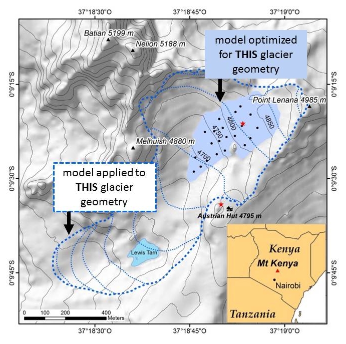 Overview map of LG, Mt. Kenya, for 2010 (0.1 km2) and the late 19th century (L19, 0.6 km2, dashed). Red stars denote AWS locations, black dots the ablation stakes. L19 outline from Patzelt et al. (1984) with reconstructed contour lines. Off-glacier contours were taken from Schneider (1964) and updated for the LG basin in 2010 (Prinz et al., 2012).
In wrapping up our work on the Lewis Glacier of Mt Kenya, we found that when we perturb the glacier conditions by supposing that the climate conditions are the ‘most glacier-friendly’ ones we can find in our measurements since 2009, the glacier still cannot not be sustained at the size it was in the late 19th century. This could be interpreted in 2 ways:
- (1) The climate of the late 19th century was so different from todays that we cannot find analogues within the conditions of the last few years (which we found appear to also be representative of the last few decades).
…. implying really big changes in the climate conditions have occurred at the summit of Mt Kenya over the last century or so.
- (2) The modern-day glacier is now so small that we cannot optimize a glacier mass balance model in a way that is representative for the former, larger glacier extent. This basically means that the gradients in weather conditions that best describe the glacier now, are not appropriate for a larger glacier as a larger glacier sets up its own microclimate and circulation system by presenting a large cold surface sitting nestled within a valley made of mainly much warmer rocks or vegetation.
…. implying that it is difficult to apply this method of determining a refined climate proxy from a glacier that is a very different scale form the one you are trying to reconstruct.
Unfortunately, from the glacier record alone it is not possible to determine which of these is more likely to be true, and other proxy climate records from the elevation of the summit of Mt Kenya (~5000m) are scarce. This work was published in the open source journal The Cryosphere, and can be accessed here:
Short paper summary: Lewis Glacier has lost > 80 % of its extent since the late 19th century. A sensitivity study using a process-based model assigns this shrinking to decreased atmospheric moisture without increasing air temperatures required. The glacier retreat implies a distinctly different coupling between the glacier’s surface-air layer and its surrounding boundary layer, underlining the difficulty of deriving palaeoclimates for larger glacier extents on the basis of modern measurements of small glaciers.
This work was also presented by Dr Rainer Prinz at the EGU conference on April 18 in Vienna in the session on Glaciers and ice caps under climate change.